Scenic Drives in South Florida
Fourteen South Florida scenic drives compared on length, scenery, tolls and fees, from the 113-mile Overseas Highway to Loop Road and Old Cutler Road. Read our take
At a glance
| Option | Toll or entry fee | Address | Area | Length | Scenery | Worth stopping at |
|---|---|---|---|---|---|---|
| 106000 Overseas Highway, Key Largo, FL 33037source | Florida Keyssource | 113source | Ocean views, Bridgessource | Seven Mile Bridgesource | ||
| $2.18source | 58000 Card Sound Road, Key Largo, FL 33037source | Florida Keyssource | Mangroves, Bridgessource | Alabama Jack'ssource | ||
| $35source | 40001 State Road 9336, Homestead, FL 33034source | Everglades & Big Cypresssource | 38source | Prairiesource | Anhinga Trailsource | |
| 36000 SW 8th St, Miami, FL 33194source | Everglades & Big Cypresssource | Swampsource | Shark Valleysource | |||
| Freesource | 52105 Tamiami Trail East, Ochopee, FL 34141source | Everglades & Big Cypresssource | 24source | Swamp, Wildlifesource | Gator Hook Slough Trailsource | |
| Freesource | 33000 Tamiami Trail East, Ochopee, FL 34141source | Everglades & Big Cypresssource | 17source | Prairie, Wildlifesource | H.P. Williams Roadside Parksource | |
| $3source | 137 Coastline Dr, Copeland, FL 34137source | Everglades & Big Cypresssource | 6source | Swampsource | Gate 7 West Main Trailsource | |
| 10901 Old Cutler Road, Miami, FL 33156source | Miamisource | 15source | Tree canopy, Grand homessource | Fairchild Tropical Botanic Gardensource | ||
| $3.25source | 4000 Crandon Blvd, Key Biscayne, FL 33149source | Miamisource | 5.4source | Bay views, Bridgessource | Cape Florida Lighthousesource | |
| $3.25source | Venetian Causeway, Miami Beach, FL 33139source | Miamisource | 2.8source | Grand homessource | Sunset Harboursource | |
| 3109 E Sunrise Blvd, Fort Lauderdale, FL 33304source | Fort Lauderdale to Jupitersource | 17source | Ocean views, Beachessource | Lauderdale-by-the-Seasource | ||
| Palm Beach, FL 33480source | Fort Lauderdale to Jupitersource | 16source | Beaches, Grand homessource | Mar-a-Lago (seen from the road)source | ||
| 500 Captain Armour's Way, Jupiter, FL 33469source | Fort Lauderdale to Jupitersource | 10source | Beachessource | Jupiter Inlet Lighthousesource | ||
| 10800 Collins Ave, Miami Beach, FL 33154source | Miamisource | 30source | Ocean views, Grand homessource | Hollywood Beach boardwalksource |






Our take
If you want one drive that is a trip in itself, the Overseas Highway runs 113 miles through the Florida Keys to Key West, with ocean views and the Seven Mile Bridge along the way. If you want the wildest scenery for nothing, Loop Road and the Turner River Road loop in Big Cypress National Preserve run 24 and 17 miles through swamp and wet prairie, and the preserve charges no entrance fee.
The real split in this table is between paved coastal and city drives and slow backroads. Old Cutler Road, the Rickenbacker and Venetian causeways, and the A1A runs from Miami Beach up to Jupiter Island are all short enough for an afternoon, while Loop Road, Turner River Road and Janes Scenic Drive trade speed for swamp, wading birds and alligators, and suit someone happy to drive under 20 mph on gravel.
Our picks
- The long road trip: Overseas Highway (Florida Keys Scenic Highway). 113 miles through the Florida Keys, with ocean views and bridges for most of the way.
- Best free wildlife drive: Loop Road Scenic Drive (CR 94). 24 miles of deep-swamp views with wading birds along the road, and $0 to enter Big Cypress.
- Best short drive in Miami: Old Cutler Road. About 15 miles under hundred-year-old banyans, with Fairchild Tropical Botanic Garden on the way.
- Best bay views near downtown: Rickenbacker Causeway to Key Biscayne. 5.4 miles of tall bridges and open bay views for a $3.25 SunPass toll, ending at Key Biscayne.
- Most remote: Janes Scenic Drive (Fakahatchee Strand). Only 6 drivable miles, but a dirt road into the largest strand swamp in Florida for $3.
Paved highway or gravel backroad in the Everglades
Five of these drives are in the Everglades and Big Cypress, and they drive very differently. The two-lane Tamiami Trail and the 38-mile Everglades Main Park Road to Flamingo are the main roads, built for ordinary traffic. Loop Road is paved only for its eastern seven miles before it turns to gravel or dirt, the Turner River, Wagonwheel and Birdon loop is a dirt road, and Janes Scenic Drive is an unimproved dirt road that is gated after about 6 miles, with the rest open only on foot or by bike.
Season matters on the backroads. The National Park Service notes that Big Cypress floods in the summer wet season, May through October, and Florida Rambler warns that parts of Loop Road can be under water then. In the dry winter months the canals beside Turner River Road concentrate fish as the water draws down, which is when the birds and alligators are easiest to see.
Tolls and park fees on South Florida scenic drives
Most of these roads cost nothing to drive, but four charge. The Rickenbacker and Venetian causeways in Miami each charge $3.25 with SunPass for a two-axle car, and Card Sound Road charges $2.18 with SunPass from October 1, 2026. All three bill by SunPass or by plate rather than cash, and a car billed by its plate pays more: $6.50 on the Miami causeways, plus a monthly invoice fee.
The Everglades Main Park Road is the only drive inside a national park fee area: $35 per private vehicle, good for seven days at every Everglades entrance, including Shark Valley on the Tamiami Trail. Visitors who are not US residents pay an extra $100 per person on top of it, unless they hold an annual or America the Beautiful pass. Janes Scenic Drive needs the $3 Fakahatchee Strand admission, paid at the ranger station in Copeland, while Loop Road and Turner River Road cross Big Cypress, which has no entrance fee.
Coastal A1A drives from Miami Beach to Jupiter
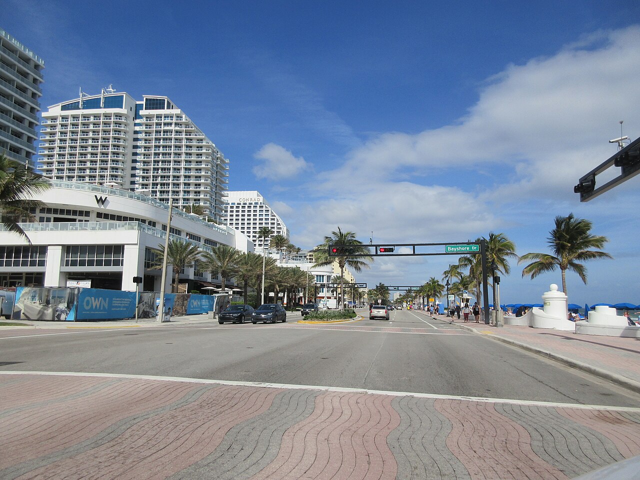
North of Miami the scenery is the Atlantic itself. The 30-mile run of A1A from South Beach to Fort Lauderdale Beach follows Collins Avenue past the condo towers of Sunny Isles Beach, with the Intracoastal on one side and the ocean on the other, and Hollywood Beach's boardwalk makes a good midway stop. The 17-mile stretch from Fort Lauderdale Beach to Boca Raton has turquoise water and busy beach towns like Lauderdale-by-the-Sea, often at 25 mph. The 16 miles from Palm Beach to Boynton Beach trade beach crowds for sea grapes and oceanfront estates, Mar-a-Lago among them, and the 10-mile Beach Road on Jupiter Island is the quietest of the four, with little public beach access and the Jupiter Inlet Lighthouse at its south end.
The options in detail
Overseas Highway (Florida Keys Scenic Highway)
The classic South Florida road trip: US 1 island-hops from Key Largo down to Key West, much of it on bridges with water on both sides. It is the drive the guidebooks put on the cover, and the stretch over the Seven Mile Bridge is the moment most people remember. Traffic and low speed limits make it slower than the mileage suggests, so plan it as a full day with stops rather than a quick run.
Card Sound Road
The back way to Key Largo: Card Sound Road leaves US 1 just below Florida City and runs through mangrove swamps to a toll bridge over Card Sound. It is not a shortcut, but it is quieter than the main highway and passes Crocodile Lake National Wildlife Refuge. Most people time the trip around a stop at Alabama Jack's, the open-air bar and fish shack by the bridge known for its conch fritters.
Everglades Main Park Road to Flamingo
The one road through the southern Everglades runs from the Ernest F. Coe Visitor Center near Homestead to Flamingo on Florida Bay, past the open marl prairie seen from the Pa-hay-okee Overlook and on to the mangrove waterways around Flamingo. Short stops near the start, like the Anhinga Trail at Royal Palm, are where most visitors get close views of birds and alligators. It is a dead end, so plan on driving it out and back, and it is the only drive here with a national park entrance fee.
Tamiami Trail (US 41) Across the Everglades
The two-lane highway that crosses the bottom of the peninsula from Miami to Naples, and the free way to see the Everglades from a car. West of Krome Avenue the city falls away and the road runs past Shark Valley, airboat stops, Clyde Butcher's gallery, the tiny Ochopee post office and a string of roadside boardwalks where alligators sun themselves. It is also the gateway to Loop Road and Turner River Road, the two gravel side trips into Big Cypress.
Loop Road Scenic Drive (CR 94)
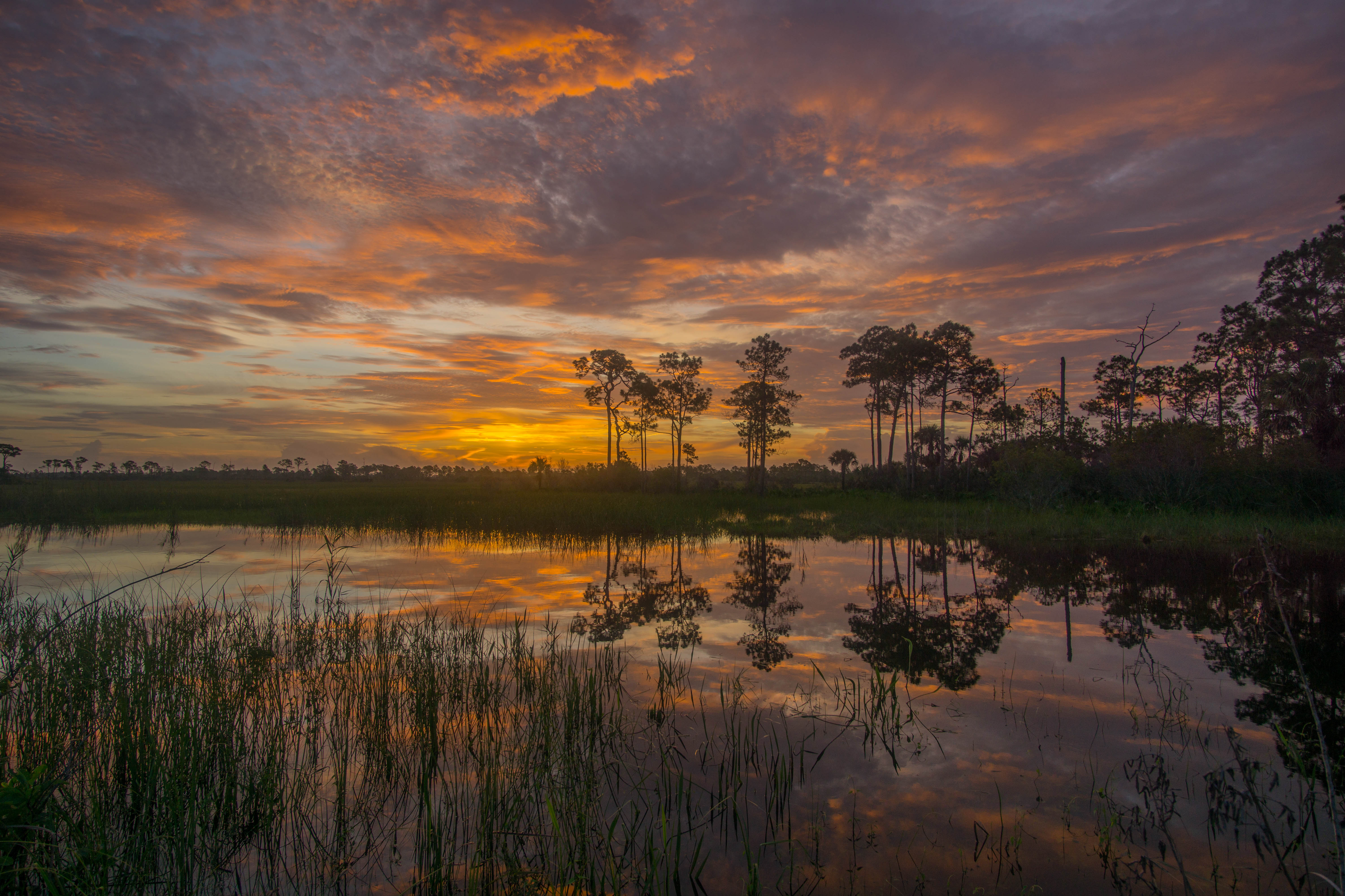
A slow detour off the Tamiami Trail through Big Cypress National Preserve, with cypress swamp pressing in on both sides and alligators, wading birds and the odd otter along the canals. The eastern end is paved and the rest is gravel or dirt, so speeds drop under 20 mph and parts can sit under water in the summer wet season. It passes the old Pinecrest settlement and the Tree Snail Hammock and Gator Hook trails, and the Oasis Visitor Center sits on US 41 between its two ends.
Turner River, Wagonwheel and Birdon Road Loop
A dirt-road loop north of the Tamiami Trail in Big Cypress that follows canals through cypress and open wet prairie. In the dry winter months the canals concentrate fish, so herons, egrets, anhingas and alligators gather along the road. The National Park Service publishes a mile-by-mile guide to the loop, and it starts at H.P. Williams Roadside Park, which has restrooms and a short boardwalk.
Janes Scenic Drive (Fakahatchee Strand)
A narrow, unimproved dirt road into Fakahatchee Strand Preserve State Park, the largest strand swamp in Florida and home to the ghost orchid. It began as a 1940s logging railroad bed, and today cars can go about six miles before a gate, with the rest open only to walkers and cyclists. Pay the park admission at the ranger station in Copeland, and stop at the numbered gates, where trails lead into the swamp.
Old Cutler Road
Miami's best-known canopy road winds south from Coral Gables toward Cutler Bay under century-old banyans and past historic stone-clad homes. It is a short, easy drive by South Florida standards, and it doubles as the way to Fairchild Tropical Botanic Garden and the Deering Estate. The two-lane pavement is bumpy, so it rewards a slow pace.
Rickenbacker Causeway to Key Biscayne
The causeway from mainland Miami over Biscayne Bay to Virginia Key and Key Biscayne, with tall bridges that give some of the best views back at the Brickell and downtown skyline. Out on the water you can pick out Stiltsville, the cluster of old houses on pilings. Crandon Park and the Cape Florida Lighthouse make the drive a half-day outing, and the causeway is a favorite with cyclists and runners, so expect company on the bridges.
Venetian Causeway
The quiet, narrow route between downtown Miami and Miami Beach, hopping across a chain of small man-made islands lined with large waterfront homes. It follows the route of the old Collins Bridge, and as the quieter, narrower way onto Miami Beach it is popular with locals. Expect joggers and people fishing along the way, and finish in Sunset Harbour for food.
A1A From Fort Lauderdale Beach to Boca Raton
The beach-road stretch of A1A north from Fort Lauderdale, close enough to the Atlantic for turquoise water views most of the way. It runs from the busy Fort Lauderdale beachfront through the small seaside village of Lauderdale-by-the-Sea and the Deerfield Beach bend to the inlet at Boca Raton. Much of it is a 25 mph crawl through busy beach towns, so it is a cruise rather than a commute.
A1A From Palm Beach to Boynton Beach
South along Ocean Boulevard from Royal Palm Way, this is the drive past Palm Beach's oceanfront estates, Mar-a-Lago among them, before the road settles into a sea-grape-lined beach road through the smaller towns toward Boynton Beach. It is a slow, scenic alternative to the inland highways for the trip between the two.
Beach Road (CR 707) on Jupiter Island
A quiet two-lane road down the length of Jupiter Island from Hobe Sound to Jupiter Inlet, past old-money estates and some of the best beaches on this coast. Public beach access is scarce, so this is a drive to enjoy from the car window rather than a beach-hopping route. The Jupiter Inlet Lighthouse and Museum by the inlet at the south end is the natural finish, and visitors can climb it.
A1A From Miami Beach to Fort Lauderdale
The beach-road run of A1A north from South Beach, following Collins Avenue through Surfside, Bal Harbour and the condo towers of Sunny Isles Beach, then into Broward through Hallandale Beach, Hollywood and Dania Beach to Fort Lauderdale Beach. For long stretches the Intracoastal Waterway and its waterfront mansions sit on one side and the ocean on the other. Hollywood Beach's boardwalk is the natural midway stop. Allow 45 minutes to an hour and a half depending on traffic, and go in the morning when the road is quieter.
How we researched this
We read National Park Service pages for Big Cypress National Preserve and Everglades National Park, the toll schedules published by Monroe County and Miami-Dade County, the Great Florida Birding and Wildlife Trail's site pages, the Friends of Fakahatchee guide to Janes Scenic Drive, and the scenic-drive guides from Florida Rambler, Florida Backroads Travel, Time Out Miami and the Miami car-rental company Luxx Miami, and recorded each value with the sentence it came from. Lengths for the causeways and the Overseas Highway come from their Wikipedia articles.
The set is the drives that recur across those guides. We left out Ocean Drive in South Beach, the MacArthur, Julia Tuttle and Broad causeways, and the short Coconut Grove streets (Main Highway and South Bayshore Drive), which are city drives of a mile or two, and the Martin Grade and Indian River Drive near Stuart, which sit on the Treasure Coast north of where most guides draw South Florida. A blank cell means no source we read stated it: no length for Card Sound Road or the Tamiami Trail, and no fee for roads that are free to drive but where no page says so. Each map pin is a visitor center or landmark at the start of the drive or along it. Tolls and park fees change, so check them before you go.