Cross-Country Ski Trails Near Garden Grove, CA
There is no snow anywhere close to Garden Grove, so every option here is a day trip. The one groomed choice is Rim Nordic Ski Area in the San Bernardino National Forest, at 6,775 feet with a $32 trail pass, and it is the only dedicated cross-country ski area in Southern California.
The other five are public land where people ski after a storm: no grooming, and at most of them no rentals. Two things separate them. Elevation decides how long the snow sticks, from 6,000 feet on Mount Laguna to 8,800 at the top of Mt. Pinos. Cost depends on whether you pay per car or per person, which can turn a $5 day into a $128 one for a carload of four.
Our picks
- A first try on skinny skis: Rim Nordic Ski Area. More than 10 miles groomed for classic and skate skiing, with rentals, lessons and a small chalet on site.
- Snow without chains or mountain driving: Mount San Jacinto State Park: Long Valley. The Palm Springs Aerial Tramway lifts you to about 8,400 feet, where a seasonal Adventure Center rents skis and snowshoes.
- Bringing the dog: Mt. Pinos Nordic Base (Chula Vista Trailhead). Dogs are allowed, the lot sits at 8,360 feet where snow lasts longest, and a $5 Adventure Pass covers the whole car.
- Experienced skiers on a wilderness route: East Tumamait Trail 21W03. The highest start in the table at 8,800 feet, reached by skiing two miles up a road closed to cars before a moderate-to-difficult wilderness trail begins.
- Gentle meadows in San Diego County: Big Laguna Trail, Mount Laguna. A 10 mile loop through open meadow and pine woodland with about 1,000 feet of climbing, for $5 a vehicle.
At a glance
| Option | Day Pass | Pass Required | Elevation | Land Manager | Dogs |
|---|---|---|---|---|---|
| $32source | Ski area trail passsource | 6,775source | San Bernardino National Forestsource | No dogssource | |
| $5source | Adventure Passsource | 8,360source | Los Padres National Forestsource | Dogs allowedsource | |
| $36.95source | Aerial tramway ticketsource | 8,400source | California State Parkssource | No dogssource | |
| $5source | Adventure Passsource | 8,800source | |||
| $5source | Adventure Passsource | 6,900source | San Bernardino National Forestsource | Dogs allowedsource | |
| $5source | Adventure Passsource | 6,000source | Cleveland National Forestsource | Dogs allowedsource |
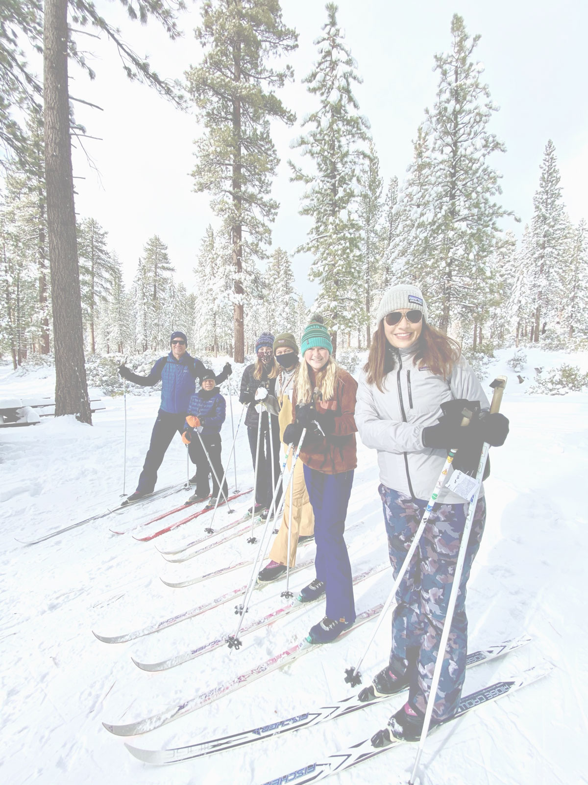


Groomed track at Rim Nordic, storm snow everywhere else
Rim Nordic is the only place in this table where a machine lays track, with runs marked green through black and two trails kept for snowshoers. Long Valley at the top of the tram is ungroomed but is the one other stop with rental skis, so both suit someone without gear.
Everywhere else you bring your own equipment and pick your moment. There are no shops or rentals anywhere on Mt. Pinos, and the Big Laguna meadows, at 6,000 feet the lowest start here, hold skiable snow for several days after a big storm rather than all winter. South Fork Trail near Barton Flats sits at 6,900 feet, and much of its lower section burned in the 2015 Lake Fire, so expect less shade and more deadfall than older write-ups describe.
Per car or per person: what a ski day costs
Four of the six need only a $5 Forest Service Adventure Pass, and that fee is per vehicle. Rim Nordic's $32 trail pass and the $36.95 tram ticket to Long Valley are per person, so a carload of four pays $5 at Mt. Pinos, $128 at Rim Nordic and $147.80 on the tram.
Long Valley has one more step: going past the ranger station into the wilderness needs a free permit from that station. Dogs split along similar lines, allowed at Mt. Pinos, South Fork (on a leash) and Big Laguna, but not at Rim Nordic in winter or on the tram.
Driving to the snow from Orange County
Rim Nordic is the shortest drive, roughly an hour and a half, across the highway from Snow Valley. Mt. Pinos is the longest at about two and a half hours, and the county closes the snow gate at the bottom of Mt. Pinos Highway when it needs plowing, so carry chains. The tram is the exception to all of it: you drive to Palm Springs, skip the mountain roads and chains entirely, and ride up.
The options in detail
Rim Nordic Ski Area
The only place in Southern California with machine-groomed cross-country trails, tucked into the San Bernardino National Forest across the highway from Snow Valley. More than 10 miles of runs are groomed for classic and skate skiing and marked green through black, with two more trails set aside for snowshoers. Rentals, lessons and a small chalet are all on site, which makes this the easiest option on this list for a first try on skinny skis. It is also the only one charging a real trail pass rather than a parking fee, and dogs are not allowed during the winter season.
Mt. Pinos Nordic Base (Chula Vista Trailhead)
The paved lot at the end of Mt. Pinos Highway is the traditional gathering point for Nordic skiing in Southern California, sitting at 8,360 feet where the snow lasts longest. Trails spread out from here toward the Mt. Pinos summit, the condor observation site and the Chumash Wilderness, and a volunteer ski patrol staffs a base at the lot on winter weekends. Nothing is groomed and there are no shops or rentals anywhere on the mountain, so bring your own gear. Plan on roughly two and a half hours from Orange County, and carry chains: the county closes the snow gate at the bottom of the road when it needs plowing.
Mount San Jacinto State Park: Long Valley
Ride the Palm Springs Aerial Tramway up out of the desert and you step off into Long Valley, a pine-ringed meadow around 8,400 feet with a ranger station and a seasonal Adventure Center that rents cross-country skis and snowshoes. Trails start at the bottom of the concrete path from the Mountain Station, so this is the rare snow day that needs no mountain driving and no chains. Nothing is groomed, and a free permit from the ranger station is required to go beyond it into the wilderness. The tram ticket makes it the priciest entry here, and dogs are not allowed on the tram or in the wilderness.
East Tumamait Trail 21W03
The Tumamait Trail leaves the top of Mt. Pinos at 8,800 feet, the highest starting point in this table, and runs west into the Chumash Wilderness toward Sawmill Mountain. The Forest Service rates it moderate to difficult over about 4.6 miles. Cars are not allowed on the forest road that reaches the trailhead, so you cover the two miles up from the Chula Vista parking lot on skis or snowshoes before the trail itself even starts. That extra approach, plus the wilderness setting and no facilities beyond a single vault toilet, makes this a route for people already comfortable navigating in snow.
South Fork Trail 1E04.1
A Forest Service designated cross-country ski and snowshoe route in the Barton Flats area, starting from a big paved lot on Jenks Lake Road at 6,900 feet. The first two and a half miles climb gently toward the San Gorgonio Wilderness boundary and the overlook at Poop-Out Hill, which is about as far as most skiers go before the terrain turns serious. Much of the lower trail burned in the 2015 Lake Fire, so there is less shade and more deadfall than older trail write-ups describe. There is a vault toilet at the trailhead and dogs are welcome on a leash.
Big Laguna Trail, Mount Laguna
Mount Laguna is San Diego County's snow country, and the Big Laguna Trail is its signature route: a 10 mile loop through oak and pine woodland and wide open meadow with about 1,000 feet of climbing. The catch is that this far south the meadows hold skiable snow for several days after a big storm rather than all winter, so this one rewards watching the forecast. When it does snow, the open meadows are the gentlest terrain on this list. Parking is $5 a vehicle at the Penny Pines turnout on Sunrise Highway, and dogs are allowed.
How we researched this
Near was read as a day's drive, because nothing within an hour of Garden Grove gets snow; the six run from about 1.5 hours away to about 2.5. Beyond the ski area and the tram, every spot is one a source names for cross-country skiing outright; Palomar Mountain State Park promises only a day in the snow and is not here. Exploration Trail 2W09X qualifies but is closed after Line Fire damage. The McGill trails on Mt. Pinos give no parking amount or elevation, and the Angeles National Forest's one designated site has no address to place it, so that range goes unrepresented. Alpine resorts such as Mountain High and Snow Summit are downhill areas, and Bear Valley Cross Country, often the top search result, is over 400 miles away in Alpine County.
East Tumamait's page never names its forest or a dog rule in its content, so those two cells are empty. The two Mt. Pinos rows have no street address in any source and are pinned to Frazier Park, about 10 miles east of and 3,500 feet below the actual trailhead. Snow on the five public-land sites comes and goes with each storm, and the office named in the Land Manager column is the one that knows today's conditions.