Day Hikes Near Los Angeles
23 day hikes near Los Angeles compared on distance, climb, time, fees and dogs, from Runyon Canyon and the Hollywood Sign to Mount Baldy. Read our take
At a glance
| Option | Round-Trip Distance | Elevation Gain | Hiking Time | Area | Main Payoff | Parking or Pass | Dogs | Drive Time from Downtown LA | Address |
|---|---|---|---|---|---|---|---|---|---|
| 2.65source | 500source | 1 to 2 hourssource | Hollywood Hills & Griffith Parksource | Summit viewssource | Parking or entrance feesource | Dogs allowedsource | 26 | 2800 East Observatory Road, Los Angeles, CA 90027source | |
| 6.4source | 1,050source | 3 to 4 hourssource | Hollywood Hills & Griffith Parksource | Summit viewssource | Freesource | Dogs allowedsource | 20 | 3200 Canyon Drive, Los Angeles, CA 90068source | |
| 2.65source | 700source | 1 to 2 hourssource | Hollywood Hills & Griffith Parksource | City viewssource | Freesource | Dogs allowedsource | 20 | 1854 North Fuller Avenue, Los Angeles, CA 90046source | |
| 2.2source | 550source | 1 to 2 hourssource | Santa Monica Mountainssource | City viewssource | Freesource | Dogs allowedsource | 41 | 2600 Franklin Canyon Drive, Beverly Hills, CA 90210source | |
| 2.5source | 315source | 1 to 2 hourssource | Baldwin Hillssource | City viewssource | Parking or entrance feesource | No dogssource | 24 | Hetzler Road & Jefferson Boulevard, Culver City, CA 90232source | |
| 2.5source | 200source | 1 to 2 hourssource | Baldwin Hillssource | City viewssource | Parking or entrance feesource | No dogssource | 31 | 4100 South La Cienega Boulevard, Los Angeles, CA 90008source | |
| 2.6source | 700source | 1 to 2 hourssource | Verdugo Mountainssource | Ruins and historysource | Freesource | Dogs allowedsource | 34 | 2300 Walnut Avenue, Burbank, CA 91504source | |
| 3.3source | 400source | 1 to 2 hourssource | San Gabriel Mountainssource | Waterfallsource | Adventure Passsource | Dogs allowedsource | 36 | Chantry Flats Road, Arcadia, CA 91006source | |
| 4.5source | 650source | 2 to 3 hourssource | San Gabriel Mountainssource | Waterfallsource | Adventure Passsource | Dogs allowedsource | 38 | Switzer Truck Trail, Tujunga, CA 91042source | |
| 7.5source | 1,510source | 4 hours or moresource | San Gabriel Mountainssource | Summit viewssource | Adventure Passsource | Dogs allowedsource | 44 | Angeles Crest Highway & Mount Wilson Red Box Road, Altadena, CA 91001source | |
| 1.6source | 350source | Under 1 hoursource | San Gabriel Mountainssource | Waterfallsource | Parking or entrance feesource | Dogs allowedsource | 44 | 1200 North Canyon Boulevard, Monrovia, CA 91016source | |
| 10source | 900source | 4 hours or moresource | San Gabriel Mountainssource | Ruins and historysource | Adventure Passsource | Dogs allowedsource | 76 | Camp Bonita Road, Azusa, CA 91702source | |
| 5.33source | 560source | 2 to 3 hourssource | San Gabriel Mountainssource | Waterfallsource | Freesource | Dogs allowedsource | 44 | 19152 Placerita Canyon Road, Newhall, CA 91321source | |
| 3.4source | 325source | 1 to 2 hourssource | Sierra Pelona Mountainssource | Rock formationssource | Freesource | Dogs allowedsource | 57 | 10700 West Escondido Canyon Road, Agua Dulce, CA 91350source | |
| 4.5source | 800source | 2 to 3 hourssource | Santa Monica Mountainssource | Rock formationssource | State park day-use feesource | No dogssource | 59 | 20829 Entrada Road, Topanga, CA 90290source | |
| 4.75source | 200source | 2 to 3 hourssource | Santa Monica Mountainssource | Ruins and historysource | State park day-use feesource | No dogssource | 56 | 1925 Las Virgenes Road, Calabasas, CA 91301source | |
| 2.6source | 300source | 1 to 2 hourssource | Santa Monica Mountainssource | Ruins and historysource | Freesource | Dogs allowedsource | 63 | Corral Canyon Road & Solstice Canyon Road, Malibu, CA 90265source | |
| 3.8source | 400source | 1 to 2 hourssource | Santa Monica Mountainssource | Waterfallsource | Parking or entrance feesource | Dogs allowedsource | 61 | 27807 Pacific Coast Highway, Malibu, CA 90265source | |
| 2.8source | 115source | 1 to 2 hourssource | Santa Monica Mountainssource | Creek and canyonsource | Freesource | Dogs allowedsource | 71 | 5875 Bonsall Drive, Malibu, CA 90265source | |
| 6.25source | 1,075source | 3 to 4 hourssource | Santa Monica Mountainssource | Summit viewssource | Freesource | Dogs allowedsource | 82 | 12896 Yerba Buena Road, Malibu, CA 90265source | |
| 2.55source | 260source | 1 to 2 hourssource | Thousand Oakssource | Waterfallsource | Freesource | Dogs allowedsource | 65 | 928 West Avenida De Los Arboles, Thousand Oaks, CA 91360source | |
| 11.3source | 3,900source | 4 hours or moresource | San Gabriel Mountainssource | Summit viewssource | Adventure Passsource | Dogs allowedsource | Mount Baldy Road & Falls Road, Mount Baldy, CA 91759source | ||
| 3source | 125source | 1 to 2 hourssource | Santa Monica Mountainssource | Creek and canyonsource | Freesource | No dogssource | 27000 Mulholland Highway, Calabasas, CA 91302source |






Our take
For a hike you can fit into a morning, Runyon Canyon and the Hollywood Sign via Brush Canyon are both about 20 minutes from downtown without traffic, free to park and open to dogs: Runyon is a 2.65-mile loop with 700 feet of climbing, the Hollywood Sign a 6.4-mile round trip that gains 1,050 feet to the top of Mount Lee. For a waterfall, Monrovia Canyon Falls is the shortest walk here at 1.6 miles, and Sturtevant Falls, 3.3 miles from Chantry Flats, is the classic.
The real split is between hikes on the edge of the city and hikes in the mountains. Apart from the Hollywood Sign climb, the Griffith Park, Runyon, Franklin Canyon, Baldwin Hills and Verdugo hikes take 1 to 2 hours on foot and sit 20 to 41 minutes from downtown. Five of the seven San Gabriel Mountains hikes need a National Forest Adventure Pass to park, and the trails out toward Topanga, Malibu Creek and Malibu are about 50 to 82 minutes away, with Sandstone Peak the farthest. The Mount Baldy loop is the longest and steepest day here at 11.3 miles and 3,900 feet of climbing.
Our picks
- Quick workout close to town: Runyon Canyon Loop. Runyon Canyon is about 20 minutes from downtown, free, and a 2.65-mile loop with 700 feet of climbing.
- Seeing the Hollywood Sign up close: Hollywood Sign via Brush Canyon (Mount Lee). Brush Canyon to Mount Lee is 6.4 miles with 1,050 feet of gain, free to park, and dogs are allowed.
- Shortest waterfall walk: Monrovia Canyon Falls. Monrovia Canyon Falls is 1.6 miles round trip with 350 feet of gain, under an hour on foot.
- Easy walk with kids: Solstice Canyon. Solstice Canyon is a free 2.6-mile hike with only 300 feet of climbing, ending at ruins and a small waterfall.
- Biggest summit day: Mount Baldy Loop. Mount Baldy is an 11.3-mile loop with 3,900 feet of gain to the highest point in the San Gabriel Mountains, about 7 hours on foot.
Waterfall hikes near Los Angeles
Six hikes here end at a waterfall. Sturtevant Falls (3.3 miles, 400 feet) and Switzer Falls (4.5 miles, 650 feet) are in the San Gabriel Mountains and both need an Adventure Pass to park. Monrovia Canyon Falls is the shortest at 1.6 miles, with a park entrance fee instead of a forest pass. Paradise Falls in Thousand Oaks and Escondido Falls in Malibu are 2.55 and 3.8 miles. The guides say Escondido is at its best when the creek is flowing strong and that Los Pinetos Waterfall in Placerita Canyon is elusive, so the winter and spring months after rain are the time to go.
Adventure Pass, parking fees and free trailheads
Eleven of these hikes are free to park, including Runyon Canyon, the Hollywood Sign via Brush Canyon, Solstice Canyon, Sandstone Peak and Vasquez Rocks. Sturtevant Falls, Switzer Falls, Strawberry Peak, Mount Baldy and the Bridge to Nowhere need a National Forest Adventure Pass, and the Bridge to Nowhere also needs a free wilderness permit. Eagle Rock and the MASH site are in state parks with a day-use fee; Malibu Creek State Park charges $12 per vehicle for the day, though walking in to the Rock Pool on the Grassland Trail from a roadside trailhead on Mulholland Highway skips that fee. At Baldwin Hills Scenic Overlook the lot near the visitor center is paid, but parking on Jefferson Boulevard is free.
Hikes with dogs and hikes without
Dogs are allowed on 18 of the 23 hikes, and Runyon Canyon is officially a dog park with off-leash areas. The five exceptions are all state park land: Baldwin Hills Scenic Overlook, Kenneth Hahn's Community Trail (dogs only on the paved park road), Eagle Rock in Topanga State Park, and both the MASH site and the Rock Pool in Malibu Creek State Park. For a city-view hike with a dog, the Hastain Trail in Franklin Canyon and Mount Hollywood in Griffith Park both allow them.
Trails still closed after the 2025 fires
Some of the best-known day hikes near Los Angeles are not on this list because they are closed. LA County says Eaton Canyon Trail and its waterfall stay closed until December 31, 2027, after the Eaton Fire, along with the Sam Merrill Trail to Echo Mountain. The Temescal Canyon Trail to the waterfall is closed until further notice after the Palisades Fire, even though Temescal Gateway Park has reopened. Parts of Topanga State Park also remain closed, so check current conditions before heading to Eagle Rock.
The options in detail
Mount Hollywood from Griffith Observatory
A short loop from the back of the Griffith Observatory lot up to one of Griffith Park's best-known summits, with the Hollywood Sign, the Observatory and downtown all in view from the top. Intersecting trails let you make it shorter or longer, and a longer version starts down in Western Canyon. The Observatory lot fills fast and often has no spaces, so plan on parking along the road below.
Hollywood Sign via Brush Canyon (Mount Lee)
The classic way to stand right behind the Hollywood Sign: wide fire roads up Brush Canyon from free lots on Canyon Drive, finishing on a paved mile to the top of Mount Lee. Many hikers turn around at the overlook about a mile and a quarter in, which already looks straight down on Hollywood. It is fully sun-exposed after the first stretch, so go early on a warm day.
Runyon Canyon Loop
LA's most famous workout hike: a set of overlapping loops above Hollywood, from under 2 miles to over 3, mostly on wide dirt and paved fire roads. It is officially a dog park with off-leash areas, and it is crowded, so treat it as exercise with people-watching rather than a quiet walk. Starting from Mulholland Drive gives a much easier walk to the top.
Hastain Trail, Franklin Canyon Park
A quiet loop in Franklin Canyon Park above Beverly Hills, with an easy lower loop and a tougher upper loop that adds a steep single track with slippery footing. Landings along the trail look out over Lower Franklin Reservoir, Coldwater Canyon and Beverly Hills. Hikers who comment on it like the views and say it is busy enough to feel safe without being crowded.
Baldwin Hills Scenic Overlook
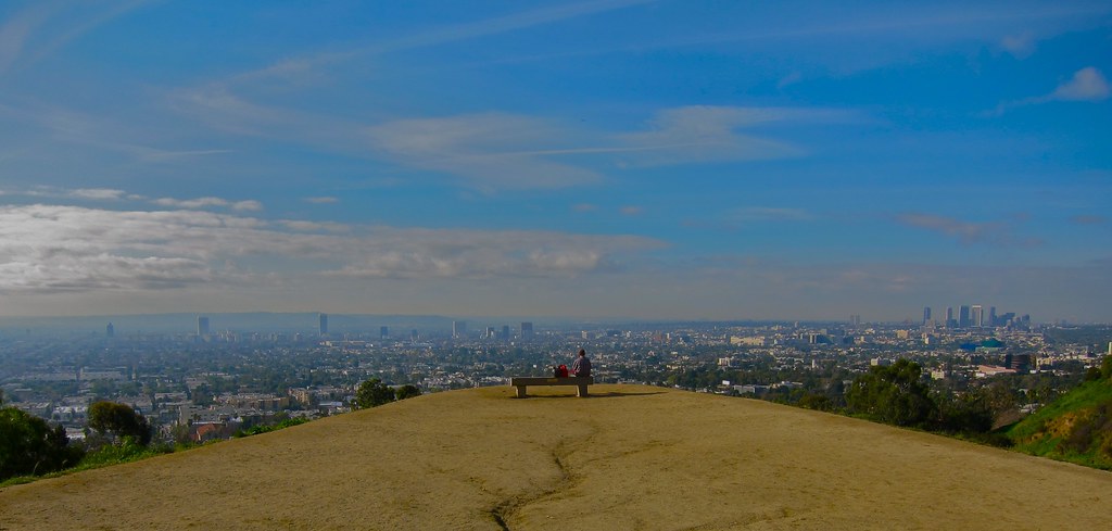
A small state park on a hill above Culver City where you choose between a zigzagging dirt trail and a stone staircase that climbs the same height in a fraction of the distance. The top looks across the whole basin, from Santa Monica Bay to downtown and the San Gabriels. Dogs and bikes are not allowed; there is a paid lot near the top and free street parking on Jefferson Boulevard.
Kenneth Hahn Community Trail
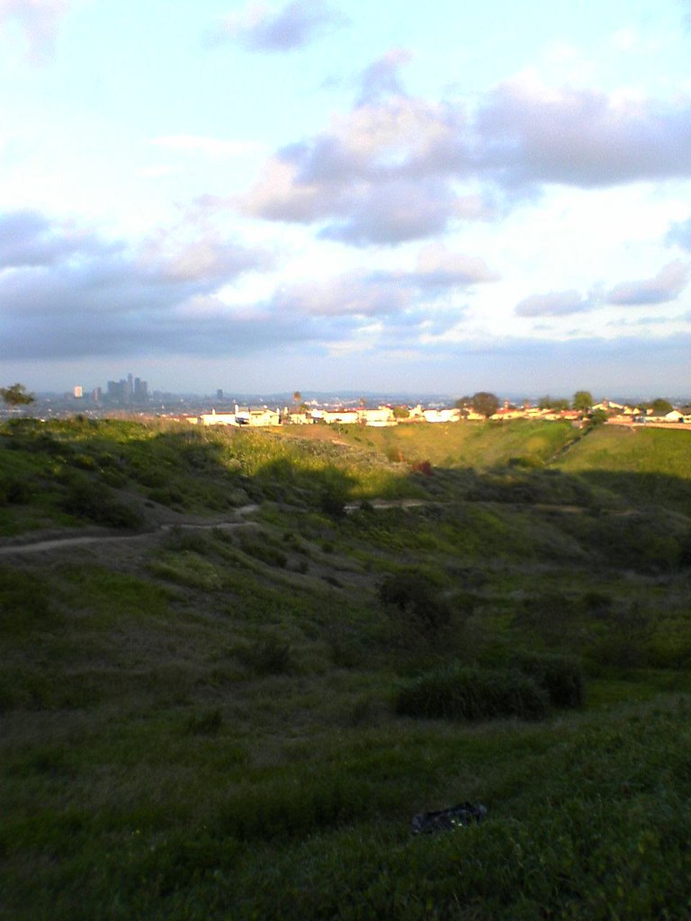
A gentle neighborhood loop around the grassy bowl of the old Baldwin Hills Reservoir, then along a ridge of viewpoints facing north over the city. The guide is honest that nearby oil fields take some of the charm out of it, and that it is a hike for people who live close rather than a destination. California State Parks allows dogs only on the paved park road, not on the trails, so leave the dog at home.
Old Youth Camp Loop, Stough Canyon
A short, steady climb from the Stough Canyon Nature Center at the end of Walnut Avenue in Burbank to the ruins of a burned-down youth camp, with an overlook across the San Fernando Valley on the way. It is easy to reach from Burbank, yet it feels deeper in the mountains than you would expect.
Sturtevant Falls
From Chantry Flats above Arcadia, the trail drops down steep pavement to Roberts Camp, then follows a creek past century-old cabins to one of the best waterfalls in the Angeles National Forest. The climb back to the car comes at the end of the day. It is among the most popular hikes in the San Gabriel Mountains, so expect company.
Switzer Falls
An upside-down hike from Switzer Picnic Area, about ten miles up the Angeles Crest Highway from Altadena, down a shaded creek to a 50-foot waterfall, passing resort-era ruins on the way. The middle section climbs along an exposed canyon wall, and the climb back out comes at the end. The picnic area at the trailhead gets crowded too.
Strawberry Peak
The highest peak in the San Gabriels' front range, reached from Red Box on the Angeles Crest Highway. The first two and a half miles are a gentle, well-built trail; the last mile and a quarter is a steep, rough ridge that the guide calls a butt-kicker. Watch for poodle-dog bush, which grew back after the 2009 Station Fire and irritates skin.
Monrovia Canyon Falls
The shortest waterfall walk here: a gentle trail from the nature center at the top of Monrovia Canyon Park, up a shaded creek lined with bays and alders to a 30-foot fall. Connect it to Bill Cull Trail for a longer and slightly steeper version. The park charges an entrance fee rather than needing a forest pass.
Bridge to Nowhere
A full-day walk up the East Fork of the San Gabriel River to a 1936 bridge left stranded when a 1938 flood washed away the road it served. The route fords the river several times, so expect wet feet and swimming holes, and set aside at least six hours. Besides a forest parking pass, you need a free wilderness permit; bungee jumpers use the bridge too.
Los Pinetos Waterfall, Placerita Canyon
A sycamore-lined canyon walk near Newhall that passes the ruins of Walker Ranch before a short climb to Los Pinetos Waterfall, which you only catch flowing if you time it right. The canyon has gold-rush history and was a backdrop for westerns, and the nature center at the trailhead gives it something for everyone. Turn around at Walker Ranch for an easier, flatter day.
Vasquez Rocks Pacific Crest Trail Loop
A desert loop on the Pacific Crest Trail through tilted sandstone slabs that have appeared in Star Trek, Blazing Saddles and The Flintstones. Add a scramble on the Famous Rocks at the center of the park, or extend the loop down the PCT through a canyon to the tunnel under Route 14. The visitor center is closed on Mondays, but the trails stay open.
Eagle Rock from Trippet Ranch
A loop from Topanga State Park's main trailhead at Trippet Ranch that climbs the fire road to a craggy sandstone summit with panoramic views and returns on the narrower Musch Trail through oak groves. Dogs are not allowed, and some parts of the park are still closed after the Palisades Fire, so check before you go.
MASH Site, Malibu Creek State Park
A nearly flat walk along Crags Road, the main trail through Malibu Creek State Park, to the corner of the park where the TV show M*A*S*H filmed its outdoor scenes. The tents are long gone but the spot is still recognizable, and the park, once a Twentieth Century Fox movie ranch, has added a lot for visitors to see. Dogs are allowed in the day use areas but not on the trails.
Solstice Canyon
A level, shaded creekside walk in Malibu that ends at the ruins of the Roberts Ranch House, designed by architect Paul Williams, beside a small waterfall. The trail is so flat it can be walked in flip-flops, which makes it one of the most family-friendly hikes in the Santa Monica Mountains. Picnic tables line the first stretch.
Escondido Falls
A two-tier waterfall in Malibu with an easy-to-reach lower tier and a much taller upper tier that is hard to get to. The hike starts from a lot just off Pacific Coast Highway and walks the first three quarters of a mile up a paved road past large homes before entering the canyon park. It is at its best when the creek is flowing strong after rain.
Zuma Canyon Trail
One of the easiest strolls in Malibu, following a stony creek bed from a coastal neighborhood into a canyon that gets shadier as oaks and sycamores close in. It ends at a jumble of boulders, where the rough Zuma Canyon Narrows begin for anyone up for serious boulder-hopping. Well-marked side loops, including Ocean View Trail on the east side of the canyon, make it easy to add more.
Sandstone Peak Loop
The high point of the Santa Monica Mountains, reached by a loop from Circle X Ranch that passes the Echo Cliffs (popular with climbers), a balancing rock, and a shady picnic area by a stream before climbing to the summit. Shade is otherwise hard to find on this hike, so bring water and start early on hot days.
Paradise Falls, Wildwood Park
A 40-foot waterfall dropping into a large pool on the Arroyo Conejo in Thousand Oaks' Wildwood Park, reached by a short loop that also visits a small cave. The walk is downhill on the way in, so the climb comes at the end, and arrows at most junctions make it hard to get lost. Add Lizard Rock, the park's other landmark, for a longer outing.
Mount Baldy Loop
The big one: a loop to the 10,064-foot top of Mount Baldy, the highest point in the San Gabriel Mountains, up past San Antonio Falls and the Sierra Club Ski Hut and back down the narrow Devil's Backbone ridge to Baldy Notch. Every route up has strenuous stretches, though none needs rock climbing, and the summit looks out to San Jacinto, San Gorgonio and Santiago Peak. The ski lift to Baldy Notch can shorten the day, and the guide warns to avoid the mountain in dangerous winter conditions.
Rock Pool via Grassland Trail, Malibu Creek State Park
An easy, nearly level loop into Malibu Creek State Park from a roadside trailhead on Mulholland Highway: across open grassland to Crags Road, past the climbing rock called Planet of the Apes Wall (the film was shot here), to the Rock Pool, a shaded pool at the mouth of a steep gorge. Starting here instead of the main lot avoids the park's vehicle entry fee. The creek can be dry by fall and needs rock hopping in spring, rangers may ticket people jumping into the pool, and dogs are not allowed on the park's trails.
How we researched this
We read each hike's Hikespeak trail guide for the round-trip distance, elevation change, estimated hiking time, whether dogs are allowed, what you need to park, and the trailhead address, and recorded each value with the sentence it came from. Franklin Canyon Park's street address comes from the Mountains Recreation and Conservation Authority's park page, and the dog rules for Kenneth Hahn, Topanga and Malibu Creek come from California State Parks' own park pages. Drive times are worked out from each trailhead's map pin to Los Angeles City Hall without traffic, so expect longer on a weekday or a summer weekend.
We checked LA County's trail closure alert for the Eaton and Palisades fires and left out trails it lists as closed, including Eaton Canyon Falls, Echo Mountain and Temescal Canyon. Fish Canyon Falls and Hermit Falls were left out because their guides mark them closed. Each distance is for one recommended route, and most of these trails have shorter or longer options. Fees and closures change, so confirm them with the park before you go.