Best Hikes Near San Diego
Seventeen San Diego County hikes compared on distance, climbing, difficulty, dogs and fees, from Cowles Mountain and Torrey Pines to El Cajon Mountain. Read our take
At a glance
| Option | Distance | Elevation Gain | Difficulty | Dogs | Fee or Permit | Payoff | Address |
|---|---|---|---|---|---|---|---|
| 2.7source | 915source | Moderatesource | Leashed dogs allowedsource | No feesource | Summit viewssource | 7001 Golfcrest Dr, San Diego, CA 92119source | |
| 7.5source | 2,000source | Moderately strenuoussource | Leashed dogs allowedsource | Parking or entrance feesource | Rock formationsource | 14644 Lake Poway Rd, Poway, CA 92064source | |
| 6source | 1,530source | Moderatesource | Leashed dogs allowedsource | No feesource | Summit viewssource | Iron Mountain Commuter Lot, Poway, CA 92064source | |
| 5source | 945source | Easy to moderatesource | No dogssource | Parking or entrance feesource | Ocean viewssource | 12600 N Torrey Pines Rd, La Jolla, CA 92037source | |
| 6source | 1,100source | Moderatesource | Leashed dogs allowedsource | Permit requiredsource | Waterfallsource | 15519 Thornbush Rd, Ramona, CA 92065source | |
| 3.9source | 1,035source | Moderatesource | Leashed dogs allowedsource | No feesource | Waterfallsource | 14850 Boulder Creek Rd, Julian, CA 92036source | |
| 4source | 840source | Easy to moderatesource | No dogssource | Parking or entrance feesource | Summit viewssource | 13652 Highway 79, Julian, CA 92036source | |
| 5source | 1,539source | Moderately strenuoussource | Leashed dogs allowedsource | Parking or entrance feesource | Summit viewssource | 13652 Highway 79, Julian, CA 92036source | |
| 4.2source | 820source | Moderatesource | Leashed dogs allowedsource | No feesource | Summit viewssource | 12031 Sunrise Hwy, Mt Laguna, CA 91948source | |
| 2source | 380source | Easysource | No dogssource | Parking or entrance feesource | Ocean viewssource | 1800 Cabrillo Memorial Dr, San Diego, CA 92106source | |
| 11source | 4,000source | Strenuoussource | Leashed dogs allowedsource | No feesource | Summit viewssource | 13775 Blue Sky Ranch Rd, Lakeside, CA 92040source | |
| 1.6source | 540source | Moderatesource | Leashed dogs allowedsource | No feesource | Narrow canyonsource | Solana Hills Dr, Solana Beach, CA 92075source | |
| 3.25source | 655source | Easysource | No dogssource | Parking or entrance feesource | Palm oasissource | Borrego Palm Canyon Campground, Borrego Springs, CA 92004source | |
| 5.2source | 1,200source | Moderatesource | Leashed dogs allowedsource | No feesource | Summit viewssource | 1209 Farmer Rd, Julian, CA 92036source | |
| 10.3source | 3,193source | Strenuoussource | Leashed dogs allowedsource | No feesource | Summit viewssource | 17090 Gunn Stage Rd, Ramona, CA 92065source | |
| 6.3source | 190source | Moderatesource | Leashed dogs allowedsource | No feesource | Waterfallsource | 12020 Black Mountain Rd, San Diego, CA 92129source | |
| 6.5source | 988source | Easy to moderatesource | Leashed dogs allowedsource | No feesource | Rock formationsource | 31049 CA-79, Warner Springs, CA 92086source |






Our take
For the classic San Diego hike, Cowles Mountain is 2.7 miles round trip with 915 feet of climbing to a summit with some of the best views inside the city limits, and there is no fee to park. For a big training day, El Cajon Mountain is the hardest hike here at 11 miles and 4,000 feet of climbing, followed by the Mount Gower Preserve trail at 10.3 miles and 3,193 feet.
The real split is what waits at the end. Eight of these hikes finish on a summit or viewpoint, from Garnet Peak at 820 feet of climbing to El Cajon Mountain. Three end at waterfalls (Cedar Creek Falls, Three Sisters Falls and Los Peñasquitos Canyon), two follow the coast (Torrey Pines State Natural Reserve and the Bayside Trail), and four have a payoff all their own: Potato Chip Rock on Mount Woodson, the eagle-shaped granite of Eagle Rock on the Pacific Crest Trail, the narrow sandstone squeeze of Annie's Canyon Trail, and the fan palm oasis of Borrego Palm Canyon.
Our picks
- Classic city summit: Cowles Mountain. 2.7 miles and 915 feet of climbing to summit views, with no fee to park.
- Easiest hike: Bayside Trail (Cabrillo National Monument). Rated easy, 2 miles round trip with only 380 feet of climbing along San Diego Bay.
- Waterfall without the climb: Los Peñasquitos Canyon Waterfall. 6.3 miles to a waterfall with just 190 feet of climbing, no fee, and leashed dogs allowed.
- Mountain summit with your dog: Cuyamaca Peak. Leashed dogs are allowed on this 5 mile, 1,539 foot climb, while neighboring Stonewall Peak allows no dogs.
- Hardest training hike: El Cajon Mountain (El Cap). Rated strenuous, 11 miles round trip with 4,000 feet of climbing.
Waterfall hikes and the heat
Cedar Creek Falls (6 miles, 1,100 feet) and Three Sisters Falls (3.9 miles, 1,035 feet) are both inverted hikes: the trail drops into a canyon first, so the climbing comes on the way back when you are tired. Both canyons can pass 100 degrees in summer, the Forest Service closes these trails during extreme heat (it shut both for most of August 2026), and Cedar Creek Falls usually stops flowing in summer, so plan them for winter or early spring.
Los Peñasquitos Canyon is the gentle alternative. At 6.3 miles it is longer than either, but its 190 feet of climbing is the least of any hike here, it follows a year-round creek, and it starts from a city park with restrooms.
Summit hikes from easiest to hardest
Among the eight summit and viewpoint hikes, Garnet Peak (820 feet), Stonewall Peak (840 feet) and Cowles Mountain (915 feet) are the shortest climbs. Volcan Mountain (1,200 feet), Iron Mountain (1,530 feet) and Cuyamaca Peak (1,539 feet) are the middle step, and Mount Gower Preserve (3,193 feet) and El Cajon Mountain (4,000 feet) are full-day efforts rated strenuous, and the county closes both preserves for all of August because of the heat. Potato Chip Rock, rated moderately strenuous like Cuyamaca Peak, climbs 2,000 feet over 7.5 miles from Lake Poway.
Where dogs are not allowed
Torrey Pines State Natural Reserve, Stonewall Peak, the Bayside Trail and Borrego Palm Canyon do not allow dogs. The other thirteen allow leashed dogs, but the trail guide warns against bringing a dog to Cedar Creek Falls or Three Sisters Falls in warm weather, says El Cajon Mountain is probably too long for the average dog, and limits dogs at Cuyamaca Peak to the paved fire road.
Parking fees and permits
Ten of these hikes cost nothing to park. Six charge a parking or entrance fee: Torrey Pines, Stonewall Peak, Cuyamaca Peak, the Bayside Trail, Borrego Palm Canyon, and Lake Poway for Potato Chip Rock, where only non-residents pay and only on weekends and holidays. Cedar Creek Falls is the one hike that needs a special day-use permit before you go. The trail guide's fee amounts are years old, so the fee cells for Torrey Pines and the Bayside Trail cite the parks' own current rates (up to $25 and $20 per vehicle); check the others with the park before you go.
The options in detail
Cowles Mountain
Probably the most hiked trail in San Diego, climbing chaparral switchbacks from the Golfcrest Drive staging area in Mission Trails Regional Park to a summit with some of the best views inside the city limits. It is short, steep and a favorite for sunrise and sunset. Expect crowds and a hard time parking at peak hours, and a lot of shared trail.
Potato Chip Rock (Mount Woodson via Lake Poway)
The western route up Mount Woodson starts at Lake Poway, climbs a steep fire road through sage scrub, then winds through a maze of giant white boulders to the summit and its famous Potato Chip Rock, a thin granite flake that looks like it juts out over the edge. The photo spot draws a line on weekends. It is the longest and steepest of the Poway climbs here, and non-residents pay to park at the lake on weekends.
Iron Mountain
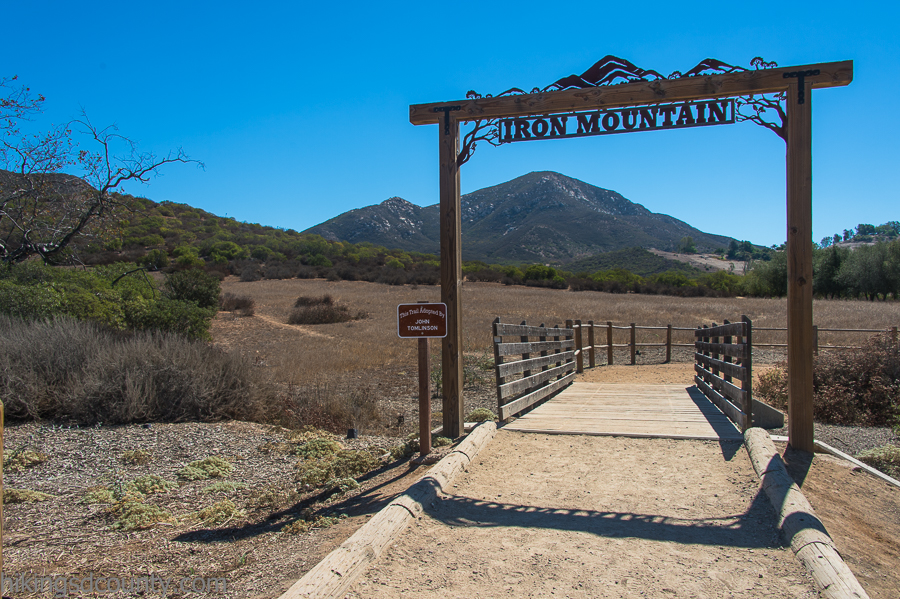
A popular Poway summit hike, second perhaps only to Cowles Mountain, starting from a lot right off Highway 67. The trail passes through an oak tunnel and then climbs open, exposed slopes to a peak with views over northeast San Diego County on a clear day. There is almost no shade, so summer afternoons are brutal; go early, when the lot also has space.
Torrey Pines State Natural Reserve
A network of short trails on the sandstone bluffs above the Pacific, home to the rare Torrey pine, which grows wild only here and on Santa Rosa Island. Linking the Guy Fleming, Razor Point, Yucca Point, Beach and Broken Hill trails makes a loop past eroded cliffs and ocean overlooks with a stop on the beach. Dogs are not allowed and parking costs more on busy days.
Cedar Creek Falls
The Ramona route drops into the San Diego River Gorge to a swimming hole at the base of an 80-foot waterfall, one of the few freshwater spots like it in the county. A special day-use permit is required. It is an inverted hike, with the climb on the way out, and the gorge is dangerously hot in summer, when the fall usually stops flowing; winter and early spring are the time to go.
Three Sisters Falls
A remote backcountry hike off Boulder Creek Road to three cascading waterfalls with pools to swim in. A newer Forest Service trail replaced the old rope-assisted descent, but it is still an inverted hike with 1,000 feet to climb back out, and rescues here are common. The canyon can top 100 degrees and the trail is sometimes closed in extreme heat; the last miles of road are dirt.
Stonewall Peak
One of the most popular hikes in Cuyamaca Rancho State Park, a fairly short climb from across the road from Paso Picacho Campground to a boulder-topped summit with a railing and sweeping views, including Lake Cuyamaca to the north. Chaparral has grown back since the 2003 Cedar Fire and gives some shade. Dogs are not allowed and the park charges for parking.
Cuyamaca Peak
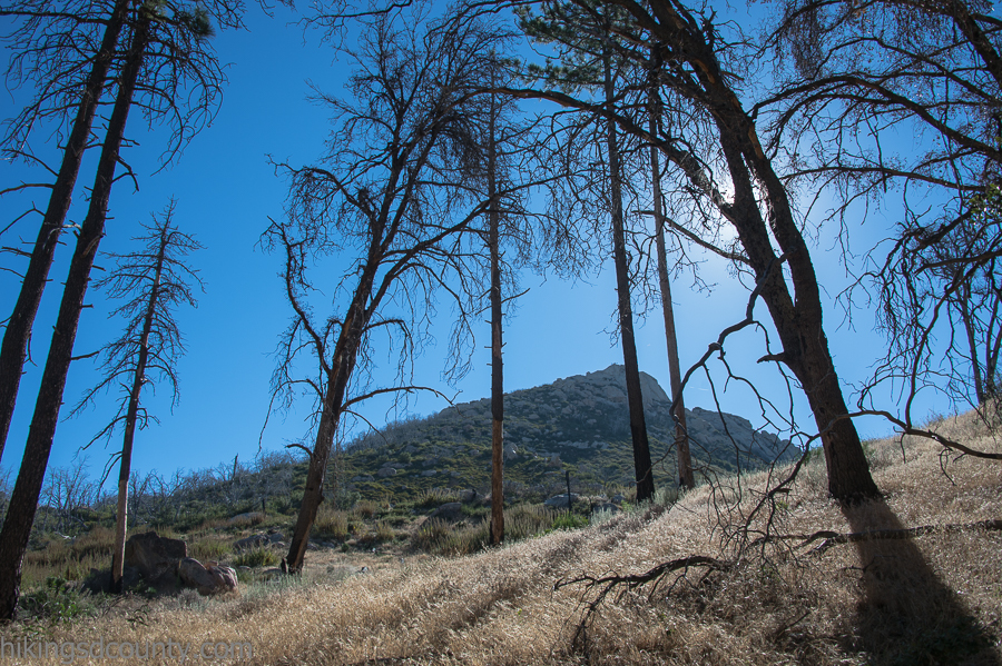
The second highest point in San Diego County, climbed most directly on the paved Lookout Fire Road from Paso Picacho Campground. The road climbs through a landscape still marked by the 2003 Cedar Fire, where charred trunks stand among regrown chaparral. Because the road is paved, it is the one hike in the park that allows dogs.
Garnet Peak
A fairly easy Laguna Mountains summit reached by following the Pacific Crest Trail north from the Penny Pines trailhead on Sunrise Highway, then branching up to the peak. The top looks over the Anza-Borrego desert far below, and spring brings wildflowers along the way. Penny Pines is the most popular start because parking is plentiful and needs no Adventure Pass.
Bayside Trail (Cabrillo National Monument)
A short trail down the bay side of the Point Loma peninsula inside Cabrillo National Monument, through coastal sage scrub with views of San Diego Bay, Coronado and the downtown skyline. The same visit can take in the Old Point Loma Lighthouse, a winter whale-watching overlook and the tide pools. It is the easiest hike here, but there is a per-vehicle entrance fee and dogs are not allowed.
El Cajon Mountain (El Cap)
One of the hardest day hikes in San Diego County, following an old mining road more than 5 miles through chaparral and boulders to the summit of the granite landmark seen from Interstate 8. Hikers call it uphill both ways because the steep ups and downs make the return nearly as hard as the climb, and people train here for Mount Whitney. There is no water, so carry plenty.
Annie's Canyon Trail
A short loop in San Elijo Lagoon Ecological Reserve that squeezes through a narrow sandstone canyon, once known as the Mushroom Caves, then climbs stairs to a viewpoint over the lagoon and the Pacific. The canyon is a tight squeeze and harder than most local hikes, so a separate out-and-back route reaches the viewpoint for those who want to skip it. Parking is on the street at the end of Solana Hills Drive.
Borrego Palm Canyon
One of the most popular trails in Anza-Borrego Desert State Park, an easy walk up a desert canyon from the back of the Borrego Palm Canyon Campground to a grove of California fan palms. Peninsular bighorn sheep come down to the oasis for water, and a pamphlet with numbered signs explains the plants and history along the way. Dogs are not allowed on the trail.
Volcan Mountain
A county wilderness preserve just north of Julian, climbing a fire road through oaks and conifers that escaped the region's big wildfires to grassy summit meadows with views east over Anza-Borrego. The return on the hikers-only Five Oaks Trail makes it a loop with glimpses of Julian below. There are no restrooms or water, and the summit can be very windy.
Mount Gower Preserve (Southern Viewpoint)
A long workout in a 1,574-acre county preserve in Ramona, winding through chaparral on the preserve's southern trail to a viewpoint above the San Vicente Valley, with over 3,000 feet of total climbing. A shorter 3.5-mile trail on the north end suits an easier day. The staging area gate opens at 8 a.m., and parking outside it adds walking each way.
Los Peñasquitos Canyon Waterfall
A nearly flat walk along year-round Peñasquitos Creek from Canyonside Community Park to a small but scenic waterfall, with the historic Rancho Peñasquitos adobe ranch house near the start. Shaded by oaks and sycamores in places, it is the gentlest climb on this list and shared with bikes on the main trail. Its length comes from distance, not elevation.
Eagle Rock
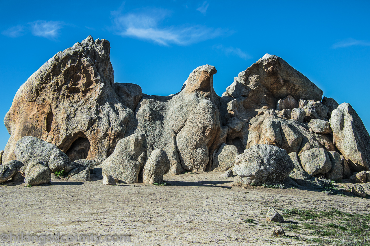
A stretch of the Pacific Crest Trail from Highway 79 in Warner Springs to a granite outcrop that looks remarkably like a giant eagle with its wings spread. The walk passes an oak-lined creek, chaparral and open grassland where cattle graze, so expect gates to close behind you. It is long but gentle, with almost no shade once you leave the creek, and the grass is green only in winter and spring.
How we researched this
We read each hike's write-up on Hiking San Diego County, a local trail guide that lists distance, total climbing, difficulty, dog rules and fees in the same format for every trail, and recorded each value with the line it came from. Trailhead addresses come from Hidden San Diego, the County of San Diego parks pages, California State Parks, the National Park Service, HikingGuy and California Through My Lens, and the current fees for Torrey Pines and Cabrillo come from the parks' own fee pages. A blank cell would mean the source did not state the detail; none were left blank here.
The set covers the hikes that local lists name most often, from the coast to the Laguna Mountains and Anza-Borrego. We left out Black Mountain, Bernardo Mountain, Double Peak and Kwaay Paay Peak, which are similar city-edge summits to Cowles and Iron Mountain, and the Lake Poway loop, which shares its trailhead with Potato Chip Rock. Distances are for the route each write-up describes, so another trailhead changes the numbers, and fees, permits and heat closures change often: confirm with the managing park before you go.