Best Hikes Near Gilroy, CA
Fifteen hikes near Gilroy compared on fee, length, climb, dogs and drive time, from Mt. Madonna's redwoods to the High Peaks of Pinnacles. Read our take
At a glance
| Option | Entry Fee | Hike Length | Elevation Gain | Route Type | Highlight | Dogs Allowed | Park Type | Address | Drive From Gilroy |
|---|---|---|---|---|---|---|---|---|---|
| $6source | 1source | 320source | Loopsource | Waterfallssource | Yessource | County Parksource | 8515 Croy Road, Morgan Hill, CA 95037source | 40 | |
| $6source | 6.8source | 797source | Loopsource | Lake or Reservoirsource | Yessource | County Parksource | 4558 Gilroy Hot Springs Road, Gilroy, CA 95020source | 20 | |
| $6source | 4.1source | 826source | Loopsource | Redwoodssource | Yessource | County Parksource | 5302 Hecker Pass Road, Gilroy, CA 95020source | 15 | |
| $8source | 10source | 1,400source | Loopsource | Swimming Holesource | Nosource | State Parksource | 9100 E Dunne Ave, Morgan Hill, CA 95037source | 47 | |
| $8source | 6.4source | 1,600source | Loopsource | Lake or Reservoirsource | Nosource | State Parksource | 9100 E Dunne Ave, Morgan Hill, CA 95037source | 47 | |
| $6source | 7.2source | 300source | Out and Backsource | Wildflowers and Grasslandsource | Nosource | State Parksource | 4826 Gilroy Hot Springs Road, Gilroy, CA 95020source | 35 | |
| $30source | 2.2source | 500source | Loopsource | Caves and Rock Formationssource | Nosource | National Parksource | 5000 East Entrance Road, Paicines, CA 95043source | 92 | |
| $30source | 6.7source | 1,425source | Loopsource | Summit Viewssource | Nosource | National Parksource | 5000 East Entrance Road, Paicines, CA 95043source | 92 | |
| $6source | 0.6source | 261source | Point to Pointsource | Summit Viewssource | Nosource | State Parksource | San Juan Canyon Road, San Juan Bautista, CA 95045source | 33 | |
| Freesource | 3source | 749source | Point to Pointsource | Wildflowers and Grasslandsource | Nosource | Open Space Preservesource | 4289 Casa Loma Rd, Morgan Hill, CA 95037source | 48 | |
| $6source | 8.4source | 672source | Loopsource | Lake or Reservoirsource | Yessource | County Parksource | 21131 McKean Road, San Jose, CA 95120source | 36 | |
| Freesource | 8source | 1,454source | Loopsource | Mining Historysource | Yessource | County Parksource | 21785 Almaden Road, San Jose, CA 95120source | 45 | |
| Freesource | 4source | 576source | Loopsource | Wildflowers and Grasslandsource | Nosource | Open Space Preservesource | 550 Palm Ave, Morgan Hill, CA 95037source | 32 | |
| $6source | 3.75source | 790source | Loopsource | Wildflowers and Grasslandsource | Yessource | County Parksource | 260 Bernal Road, San Jose, CA 95119source | 42 | |
| Freesource | 8.3source | 1,195source | Out and Backsource | Summit Viewssource | Nosource | Open Space Preservesource | Mt Umunhum Rd, San Jose, CA 95120source | 56 |







Our take
For a good hike close to town, the Merry-Go-Round Loop at Mt. Madonna County Park is a 15 minute drive from Gilroy and spends its 4.1 miles in redwood forest for a $6 parking fee. For the most payoff for the least effort, the Waterfall Loop Nature Trail at Uvas Canyon County Park passes a run of waterfalls in 1 mile with 320 feet of climbing.
The real split in this table is who runs the land. All six county parks here allow leashed dogs and charge $6 or nothing, while Henry W. Coe State Park, Fremont Peak, Pinnacles National Park and the three open space preserves keep dogs off the trails entirely. The second split is distance against climbing: Hunting Hollow Road covers 7.2 miles with about 300 feet of gain, while the Middle Ridge Loop packs 1,600 feet into 6.4 miles.
Our picks
- Closest to Gilroy: Merry-Go-Round Loop at Mt. Madonna County Park. A 15 minute drive to a 4.1 mile redwood loop, $6 to park, and leashed dogs are welcome.
- Short and easy: Waterfall Loop Nature Trail at Uvas Canyon County Park. 1 mile and 320 feet of climbing past a string of waterfalls, best when the creek is running.
- Free, with a dog: Quicksilver History Loop at Almaden Quicksilver County Park. No entry fee, leashed dogs allowed, and 8 miles through old mercury mining country.
- Long but gentle: Hunting Hollow Road at Henry W. Coe State Park. 7.2 miles out and back with only about 300 feet of gain, starting on the edge of Gilroy.
- Biggest summit view: Mount Umunhum Trail at Sierra Azul Open Space Preserve. 8.3 miles and 1,195 feet of climbing to a summit with views from the Pacific to the Sierra Nevada, free to enter.
Where you can hike with a dog near Gilroy
Leashed dogs are allowed on six of these hikes, and every one is in a Santa Clara County park: Uvas Canyon, Coyote Lake Harvey Bear Ranch, Mt. Madonna, Calero, Almaden Quicksilver and Santa Teresa. Everywhere else the answer is no. Henry W. Coe State Park allows dogs only on paved areas and one short trail at the Coe Ranch entrance, Pinnacles bans pets from all trails, and the Open Space Authority keeps dogs off Rancho Cañada del Oro and Coyote Valley altogether. Mount Umunhum goes furthest: no dogs on the trail, the summit, the parking lots or even in cars on the access road.
Free hikes and what the parking fees cover
Four hikes cost nothing: the Mayfair Ranch Trail, the Arrowhead Loop Trail, the Quicksilver History Loop and the Mount Umunhum Trail. The county parks charge $6 per vehicle per day, and Uvas Canyon also needs a pre-paid day pass booked ahead. Henry W. Coe charges $8 at the Coe Ranch entrance but $6 at Hunting Hollow, paid in cash or check in a self-registration envelope. Pinnacles at $30 looks like the outlier, but that is a vehicle pass good for up to 7 days, so it is the better value if you go back for both Pinnacles loops on one trip.
Miles versus climbing
Length alone is a poor guide here. Hunting Hollow Road at 7.2 miles and the Rancho San Vicente Loop at 8.4 miles both climb less than 700 feet, so they suit a group that wants a long walk without a hard one. The Middle Ridge Loop at 6.4 miles, the High Peaks to Bear Gulch Loop at 6.7 miles and the Quicksilver History Loop at 8 miles all climb more than 1,400 feet. Two rows are one way, not round trip: the Peak Trail at Fremont Peak (0.6 miles) and the Mayfair Ranch Trail (3 miles), so double those for the walk back.
Shade, heat and the best season
Most of these hikes are open grassland that is green and full of wildflowers from late winter through spring and hot and dry by summer. Hunting Hollow, Santa Teresa, the High Peaks at Pinnacles and the upper Mount Umunhum Trail have little or no shade, so start early from May on. The Merry-Go-Round Loop is the exception, mostly under redwoods, and it is the one to choose on a hot afternoon. China Hole is worth the 10 miles mainly in late spring and early summer, when the pool still holds water.
The options in detail
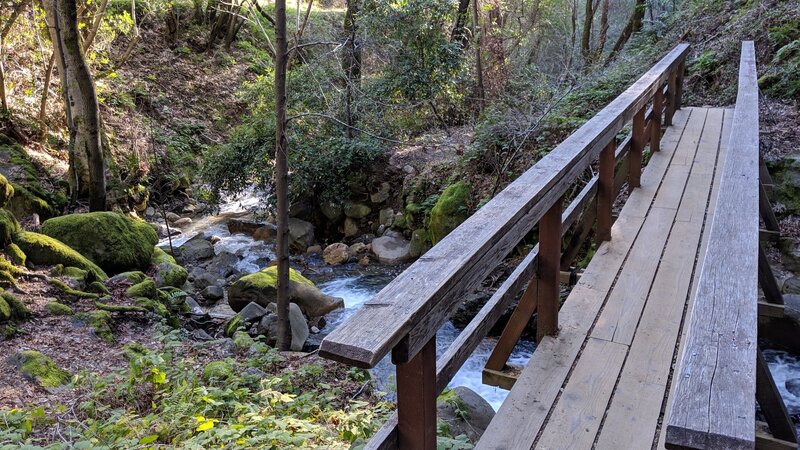
Waterfall Loop Nature Trail at Uvas Canyon County Park
A one-mile self-guided nature loop along Swanson Creek that passes a string of named waterfalls, with short side spurs to the best of them. It is the shortest real payoff in the area and works for almost any group, but it is only at its best from late winter into spring, when the creek is running. Santa Clara County requires a pre-paid vehicle day pass to enter Uvas, so book before you drive out.
Coyote Lake and Ridge Hike at Coyote Lake Harvey Bear Ranch County Park
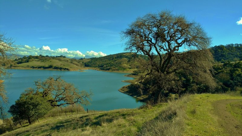
The closest substantial hike to Gilroy, in the big county park in the hills just east of town. The loop climbs from oak meadows onto Coyote Ridge, and the reservoir stays in view below for much of the way back. The hills are green in winter and spring and gold by late summer, when the open ridge gets hot. The route starts from the Mendoza Ranch side on Roop Road rather than the main lakeside entrance, so check the park map before you set off.
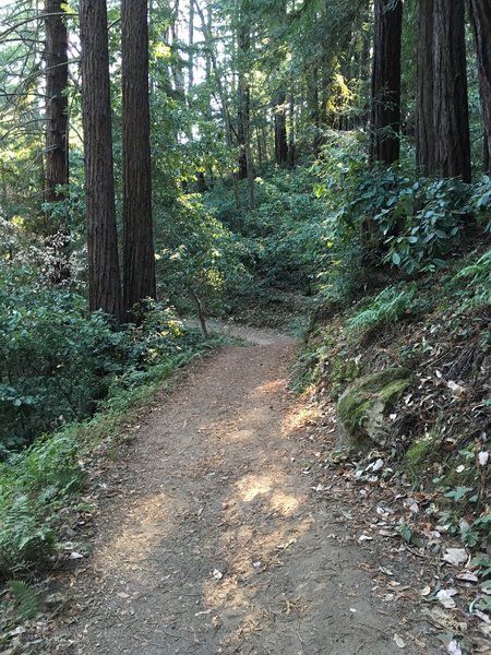
Merry-Go-Round Loop at Mt. Madonna County Park
The redwood hike on this list, and the easiest escape from the heat, since most of it is under tall trees. From the Sprig day use area the route climbs steadily, sometimes steeply, through a fine stand of redwoods before returning along the ridge. Mt. Madonna sits on Hecker Pass about twenty minutes west of Gilroy and also holds the ruins of Henry Miller's summer estate and a small herd of white fallow deer, both easy side trips.
China Hole Loop at Henry W. Coe State Park
Coe's classic day hike: ten miles from the Coe Ranch visitor center, past the old Madrone Soda Springs resort site and down to China Hole, the park's best-known swimming hole on Coyote Creek. Late spring and early summer are the window, when there is water in the pool and the heat has not yet set in. The climb back out is the hard part, and poison oak lines parts of the route, so this is a full day for fit hikers rather than a casual outing.
Middle Ridge Loop at Henry W. Coe State Park
A shorter taste of Coe's backcountry from the same Coe Ranch trailhead as China Hole. The loop passes the Coe monument and Frog Lake, crosses the Little Fork of Coyote Creek twice and follows a long stretch of ridgetop through manzanita that has grown as tall as trees. The gain is the most of any hike here for its length, spread over several steep pitches, especially on the climb back up to Pine Ridge.
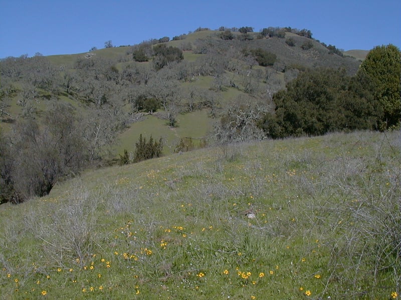
Hunting Hollow Road at Henry W. Coe State Park
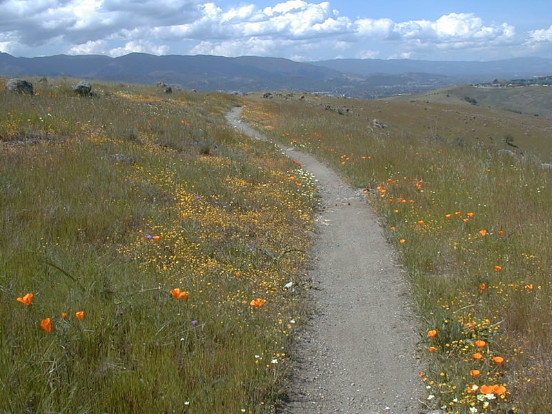
The gentle way into Henry Coe, starting from the park's Hunting Hollow entrance right on the edge of Gilroy. The route follows a valley road up the creek through a run of meadows and oaks, with many creek crossings that can mean wet feet after rain, and turns around at the Wagon Road junction. Spring wildflowers here are excellent, but the valley is almost entirely exposed, so it is a poor choice in a heat wave. The entrance is unstaffed and the fee is paid by cash or check in a self-registration envelope.
Moses Spring to Rim Trail Loop at Pinnacles National Park
The short, family-friendly Pinnacles loop: a walk up from the Bear Gulch day use area through the Bear Gulch talus cave, where you climb between boulders in the dark, to Bear Gulch Reservoir set among rock walls, then back along the rim. Bring a flashlight or headlamp for each person. The cave closes at times to protect roosting bats and can flood after winter rain, so check its status with the park before you go. Pinnacles is the longest drive on this list, down Highway 25 past Hollister to the east entrance.
High Peaks to Bear Gulch Loop at Pinnacles National Park
The park service's own pick for the best of Pinnacles in one day. The loop climbs from Bear Gulch through meadows that fill with wildflowers in spring onto the High Peaks, crosses the rock spires on narrow trail with handholds cut into the stone, and comes down through shady woodland. Condors are often seen overhead. The high section is exposed with real drop-offs and no shade, so start early, carry plenty of water and skip it on a hot afternoon.
Peak Trail at Fremont Peak State Park
The least walking for the widest view: a short, rocky trail from the upper parking area to the summit of Fremont Peak, which looks out over Monterey Bay and the Salinas Valley. The drive is the real effort, up a long, narrow, winding road off Highway 156 near San Juan Bautista. The park also has an observatory that holds public evenings, which makes this a good one to stay for at sunset.
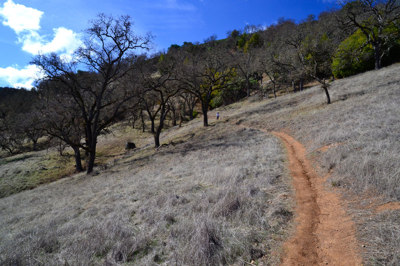
Mayfair Ranch Trail at Rancho Cañada del Oro Open Space Preserve
A steady climb through oak woodland onto an open ridge, with the views widening the whole way toward the Santa Cruz Mountains. It is one way, so the full walk is about six miles there and back, though turning round at the ridge makes a shorter outing. March through May the meadows are full of wildflowers. Parking is free, and dogs are banned entirely, not just leashed, because of the sensitive habitat.
Rancho San Vicente Loop at Calero County Park
A long walk that never gets steep: the loop heads into Calero's backcountry, follows Cherry Canyon Creek down to Calero Reservoir and runs the shoreline to the dam before crossing open hillside back to the car. Wild turkeys, geese and deer are common, and the hills turn green in winter ahead of the spring wildflowers. Start from the Rancho San Vicente entrance on McKean Road, not the boat launch area.
Quicksilver History Loop at Almaden Quicksilver County Park
A hike through what was once one of the world's most productive mercury mining districts. The loop climbs from the Hacienda entrance past old tunnel mouths, mine building remains and interpretive signs, on wide, well-kept trail, and the mining museum near the trailhead fills in the rest of the story. It is a solid half day with a fair amount of climbing, and there is no entry fee.
Arrowhead Loop Trail at Coyote Valley Open Space Preserve
The quick, low-commitment option: one signed loop, free parking and a short drive up Highway 101 from Gilroy. The trail passes serpentine rock outcrops and winds through grassland and oak and bay woodland, with views across to Mount Hamilton and Mount Umunhum, and the hillsides fill with wildflowers in spring. The lot is small and fills on weekend mornings, and dogs are not allowed anywhere on the preserve.
Coyote Peak Loop at Santa Teresa County Park
A short loop in the hills at the south edge of San Jose that climbs from the Pueblo day use area to Coyote Peak, where a summit spur with benches looks out across the whole valley, then returns along open grassy ridges. Spring wildflowers on the serpentine slopes are the main draw. The trails are poorly signed and many unofficial paths branch off, so carry a map, and expect almost no shade.
Mount Umunhum Trail at Sierra Azul Open Space Preserve
A well-graded climb up one of the highest peaks in the Santa Cruz Mountains, from the Bald Mountain parking area to the summit of Mount Umunhum, through oak, madrone and manzanita with plenty of switchbacks. The top has a restored summit area, interpretive signs and the old Cold War radar tower, and the view reaches from Silicon Valley to Monterey Bay on a clear day. About a third of the trail is in full sun and the trailhead lot is small, so start early. No dogs at all on this part of the preserve, not even in cars.
How we researched this
We read the pages each land manager publishes, from Santa Clara County Parks, California State Parks, the National Park Service, the Santa Clara Valley Open Space Authority and the Midpeninsula Regional Open Space District, along with the Pine Ridge Association's Henry Coe trip guides and trail write-ups on Hiking Project and Bay Area Hiker, and recorded each value with the sentence it came from. Drive times are computed driving routes from central Gilroy without traffic, so treat them as a rough guide; the Pinnacles figure in particular reads longer than many people find the drive.
The set covers the strongest day hikes within reach of Gilroy, one or two per park. Pacheco State Park was left out because no trail lengths or climbs are published for it and its Dinosaur Lake Trail is closed, the Forest of Nisene Marks because the trail to Five Finger Falls is closed and the park gives no street address, and Elkhorn Slough because its published trail lengths disagree. Fees, closures and reservation rules change, so check the park's own page before you drive.