Fall foliage drives near Yorba Linda
Updated .
| Option | Address | County | Mountain Range | Scenic Route | Fall Color Trees | Trip Type |
|---|---|---|---|---|---|---|
The nearest honest fall-color stop to Yorba Linda, reached by turning inland off I-5 at San Juan Capistrano and climbing the Ortega Highway into the Santa Ana Mountains. Its 8,000 acres of oak and sycamore woodland drop orange leaves across wide, mostly flat trails, which makes it the easiest walk on this list for small children or anyone who does not want a mountain hike. It is a wilderness park rather than a town, so there is nowhere to buy lunch and you plan around the gate hours. Ranger-guided walks and three campgrounds run through the season. | 33401 Ortega Highway, San Juan Capistrano, CA 92675source | Orangesource | Santa Ana Mountainssource | Ortega Highway (State Route 74)source | California sycamore and coast live oaksource | State parksource |
Orange County's own canyon drive, about half an hour from Yorba Linda: Santiago Canyon Road runs along the base of the Santa Ana Mountains, and two narrow side canyons branch off it into oak and sycamore shade. Tucker Wildlife Sanctuary sits at the head of Modjeska Canyon with a small natural history museum, a bird observation deck and short trails, open Saturdays and Sundays. This is the lowest and mildest option here, and the sources describe the canyons and the sanctuary rather than a documented autumn display, so treat it as a scenic canyon drive with a nature stop rather than a guaranteed leaf show. | 29322 Modjeska Canyon Rd, Silverado, CA 92676source | Orangesource | Santa Ana Mountainssource | Modjeska Canyon Roadsource | Canyon roadsource | |
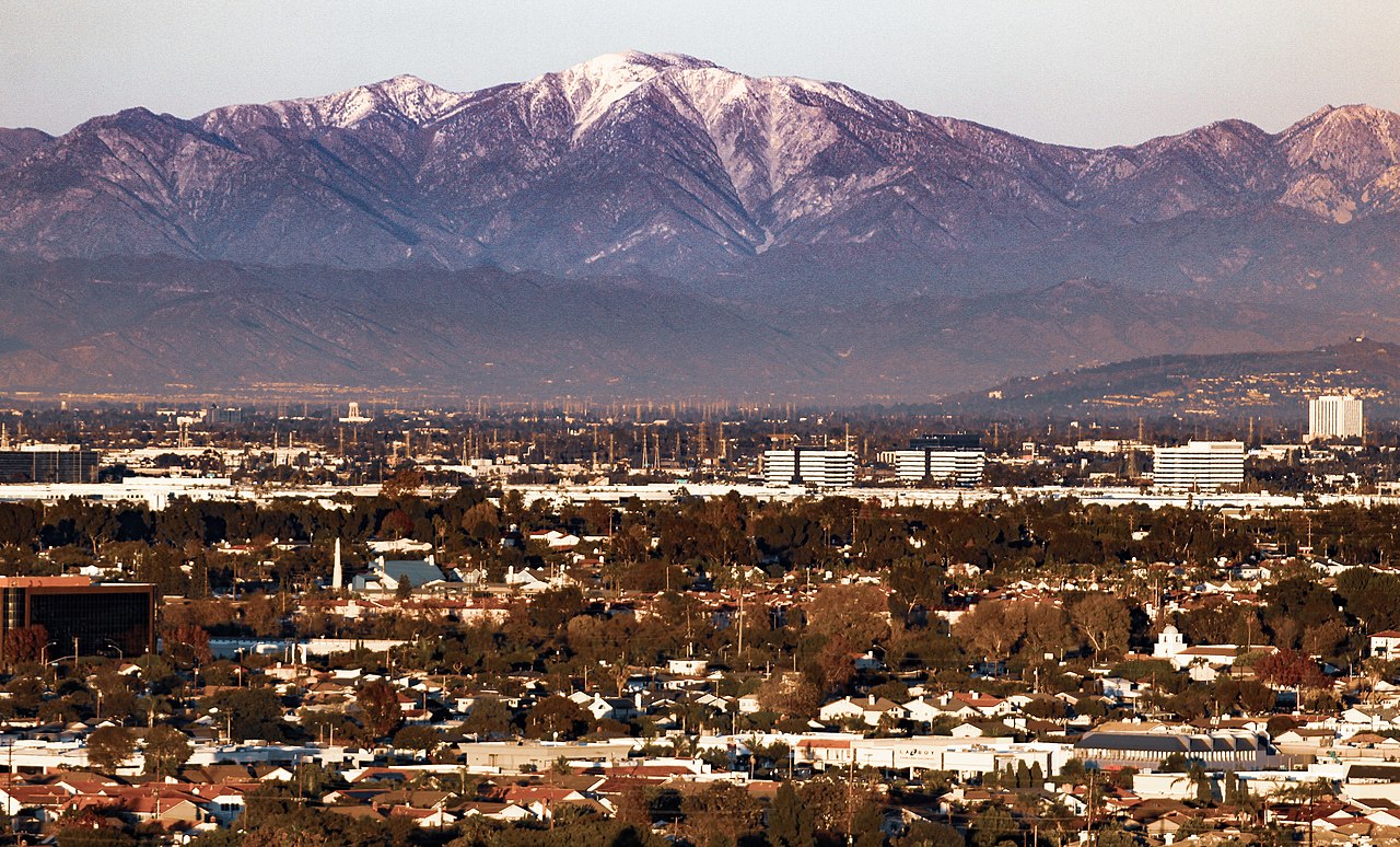
The closest genuinely alpine drive to Yorba Linda: Mount Baldy Road leaves the edge of Claremont and climbs San Antonio Canyon to a small village under Southern California's most recognisable peak, roughly an hour away. The Forest Service keeps a visitor center in the village, staffed on weekends by the San Gabriel Mountains Heritage Association. Parking at the trailheads needs a National Forest Adventure Pass, sold at the visitor center. Published fall-color guides say much less about Baldy than about the mountain towns further east, so come for the canyon drive and the height, and treat the color as a bonus. | Mt. Baldy Village, CA 91759source | San Bernardinosource | San Gabriel Mountainssource | Mount Baldy Roadsource | Canyon roadsource | |
The classic Southern California autumn day trip, about an hour and a quarter east of Yorba Linda. Oak Glen Road runs a five-mile loop past apple growers, cider houses, farm stands and a couple of restaurants above Yucaipa, high enough that the air is cool and the native oaks and sycamores turn alongside the orchards. The season runs from Labor Day to Thanksgiving and weekends are genuinely crowded, so the loop road crawls when the farms are full. Go on a weekday if you can, and treat it as a food-and-orchards outing rather than a hike. | 39611 Oak Glen Road, Oak Glen, CA, 92399source | San Bernardinosource | San Bernardino Mountainssource | Oak Glen Roadsource | Native oaks and sycamores among apple orchardssource | Apple orchard countrysource |
The highest drive within easy reach, and the one that feels least like Southern California. State Route 2 runs the crest of the San Gabriel Mountains for 66 miles, and the eastern end above Wrightwood reaches the Big Pines area and the Grassy Hollow Visitor Center, where a canopy of oak and poplar turns red and yellow over an easy self-guided trail. Reckon on about ninety minutes from Yorba Linda. Check road status before you go: the crest highway closes in sections for snow and rockfall, sometimes well before winter. | 24510 State Highway 2, Wrightwood, CA 92397source | San Bernardinosource | San Gabriel Mountainssource | Angeles Crest Highway (State Route 2)source | Oak and poplarsource | Mountain bywaysource |
The quietest stop on this list, and the easiest to combine with a longer loop. Silverwood Lake sits on Highway 138 at the western end of the Rim of the World country, close enough to I-15 that you can reach it in about an hour and carry on to Lake Arrowhead or Big Bear afterwards. State Parks singles it out for its autumn vista of black oaks nestled among pines, seen from the shoreline and the hiking trails rather than from a village street. There are swimming beaches, boat ramps and picnic areas, so it suits a half-day with the car unpacked. | 13990 Sawpit Canyon Rd, Hesperia, CA, 92345source | San Bernardinosource | San Bernardino Mountainssource | Highway 138source | Black oaks among pinessource | State parksource |
About ninety minutes from Yorba Linda, and the drive is the point: the Rim of the World Scenic Byway runs the ridge above San Bernardino with the whole valley on one side and forest on the other. Arrowhead itself is a lakeside village of restaurants and shops around a private lake, so the walking is easy and the day can be as short as lunch and a stroll. The colour comes from pine, cedar and dogwood in the surrounding national forest rather than from a solid wall of deciduous trees. Traffic on the byway backs up badly on autumn weekends. | 27984 CA-189, Lake Arrowhead, CA 92352source | San Bernardinosource | San Bernardino Mountainssource | Rim of the World Scenic Bywaysource | Pine, cedar and dogwoodsource | Alpine lakesource |
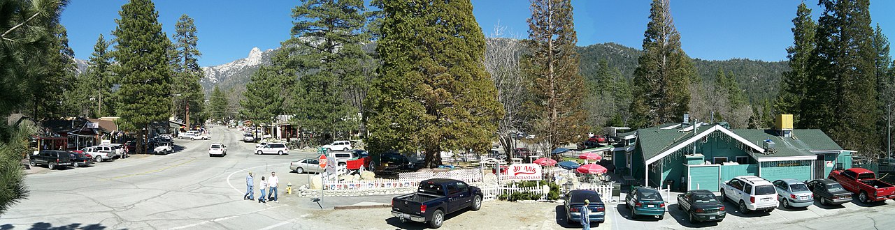
A mile-high village in the San Jacinto Mountains, reached by climbing Highway 243 out of Banning, and the best of these drives if you want a walkable town at the end of it. Idyllwild is a small grid of galleries, cafes and cabins under granite domes, surrounded by forest where oaks and maples turn red and orange. The Nature Center a mile north on 243 has trails and a museum and makes a good first stop. The road up is steep and winding with few passing places, so allow more time than the mileage suggests. | 25225 Highway 243, Idyllwild, CA 92549source | Riversidesource | San Jacinto Mountainssource | Highway 243source | Oaks and maplessource | Mountain townsource |
The biggest and highest of the mountain resorts within reach, roughly two hours from Yorba Linda by way of the Rim of the World byway or Highway 38 through Mentone. Cottonwoods and aspens along the shoreline give the most reliable yellow-to-red display in Southern California, and mid-October to early November is the window most guides point at. Because it is a full resort town there is a lot to do beyond looking at leaves: a lake to paddle, a village to walk, Oktoberfest most weekends. It is also the busiest, so book ahead if you want to stay over. | 40824 Big Bear Blvd, Big Bear Lake, CA 92315source | San Bernardinosource | San Bernardino Mountainssource | Rim of the World Scenic Bywaysource | Cottonwoods and aspenssource | Alpine lakesource |
The most Sierra-like corner of San Diego County, about two hours south of Yorba Linda and reached by the steep, tightly wound County Road S6 up from Highway 76. The park averages around 5,000 feet, with meadows, conifer forest and long views west to the ocean from Boucher Hill. Its autumn signature is unusual: not a tree at all, but bracken fern turning golden brown across the meadows against dark green forest. There are no gas stations on the mountain, so fill up before you start the climb, and the observatory a few miles on makes an easy add-on. | 19952 State Park Drive, Palomar Mountain, CA 92060source | San Diegosource | Palomar Mountainsource | County Road S6source | Bracken fern in the meadowssource | State parksource |
A gold-rush town turned apple town, and the furthest of these drives at roughly two hours south. The approach on State Route 79 through Santa Ysabel is half the pleasure, and the chamber runs a fall colour photo report each October so you can check what is turning before you commit to the drive. Julian's colour comes from its apple orchards and the oaks around them, and it arrives later than in the mountains north of here, usually late October into early November. Main Street is small and the pie shops queue out of the door on weekends. | 2129 Main Street, Julian, California, 92036source | San Diegosource | Cuyamaca Mountainssource | State Route 79source | Apple orchardssource | Mountain townsource |
Fifteen miles south of Julian on the same highway, and the best pure walking of the southern options: 26,000 acres of oak woodland, meadows and creeks with over a hundred miles of trail. State Parks names the black oak as its main fall colour tree, turning a golden yellow through the woodland. Paso Picacho at 5,000 feet is where most of the popular hikes start, including Stonewall Peak and the climb up Cuyamaca Peak. Day use is charged per vehicle, or you can park in legal turnouts along Highway 79 and walk in for nothing. | 13652 Highway 79, Julian, CA 92036source | San Diegosource | Cuyamaca Mountainssource | Highway 79source | Black oaksource | State parksource |